06.04.16
Getting an aerial view
Source: RTM Apr/May 16
Edd Fowler from the Rail Infrastructure Network Model (RINM) team at Network Rail discusses the roll-out of the company’s aerial survey data, and the benefits it will deliver.
Back in 2014, Network Rail conducted and completed an aerial survey of all the 16,000 kilometres of its routes, capturing the condition of the network in several different types of imagery.
Completed as part of the Offering Rail Better Information Services (ORBIS) programme, the team used data from the national aerial survey to produce the first version of its mapping tool, the Geo-RINM Viewer.
Following the collection and processing of the data, the Geo-RINM Viewer was deployed in September 2014 allowing approximately 4,500 users to view Network Rail’s assets on a map. Since then, the infrastructure owner has been rolling out the aerial survey imagery on a route-by-route basis, which was completed as RTM went to press.
Although roll-out of the aerial survey data has been slower than expected, due to the complexity of processing and patching the images of the network together, the team says it has now been fully rolled out and is delivering a multitude of benefits.

Edd Fowler from the RINM team told us: “We are finding that our users are finding it inherently valuable to see any part of the network in high-resolution imagery before they even go to site.
“It has been a complex task to process all the data. But when you consider the terabytes of imagery we’ve been processing and stitching together like a quilt across the network, and then uploading it onto our web-based tool so all our users can access it at the click of a button, it’s not surprising.”
Imagery types
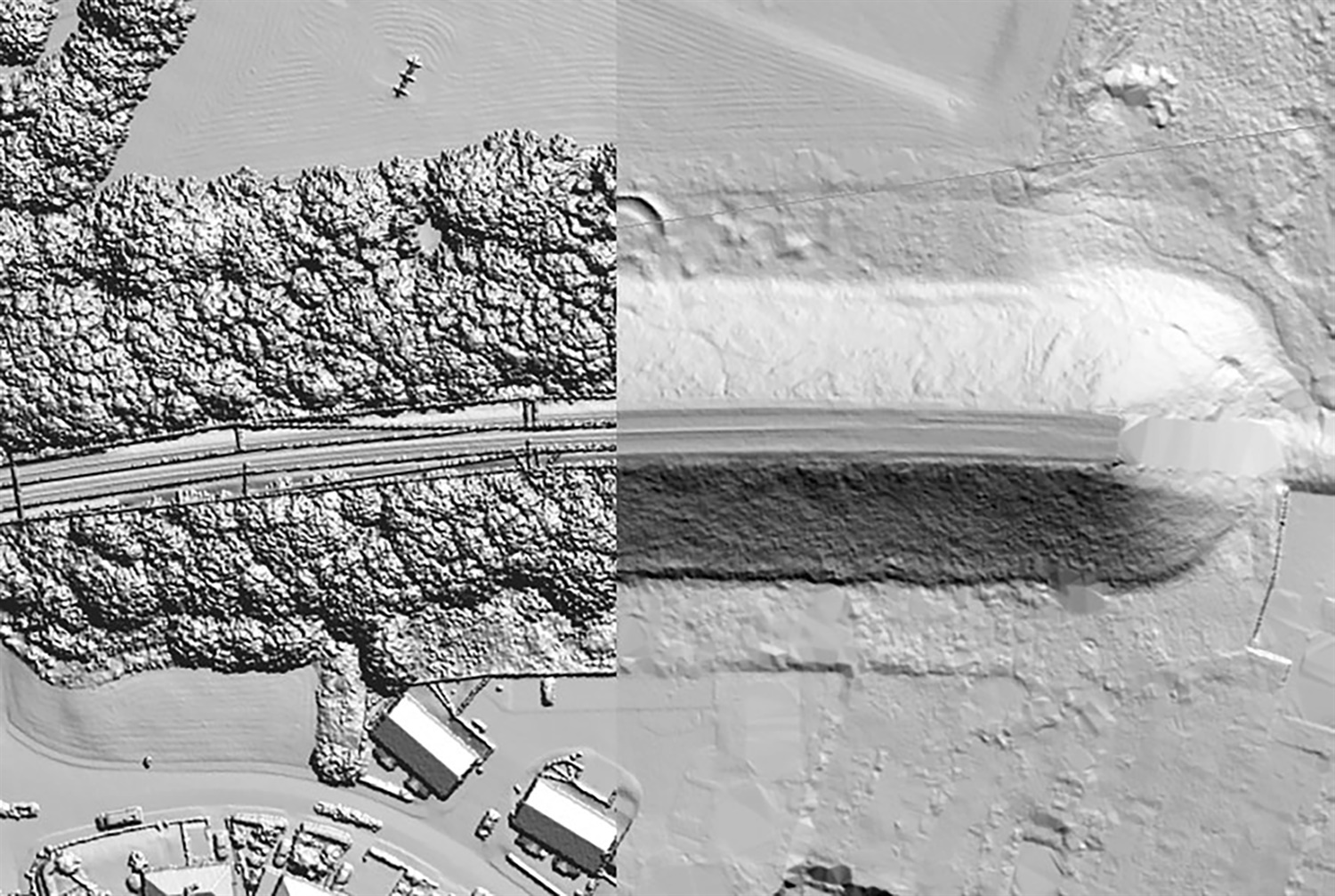
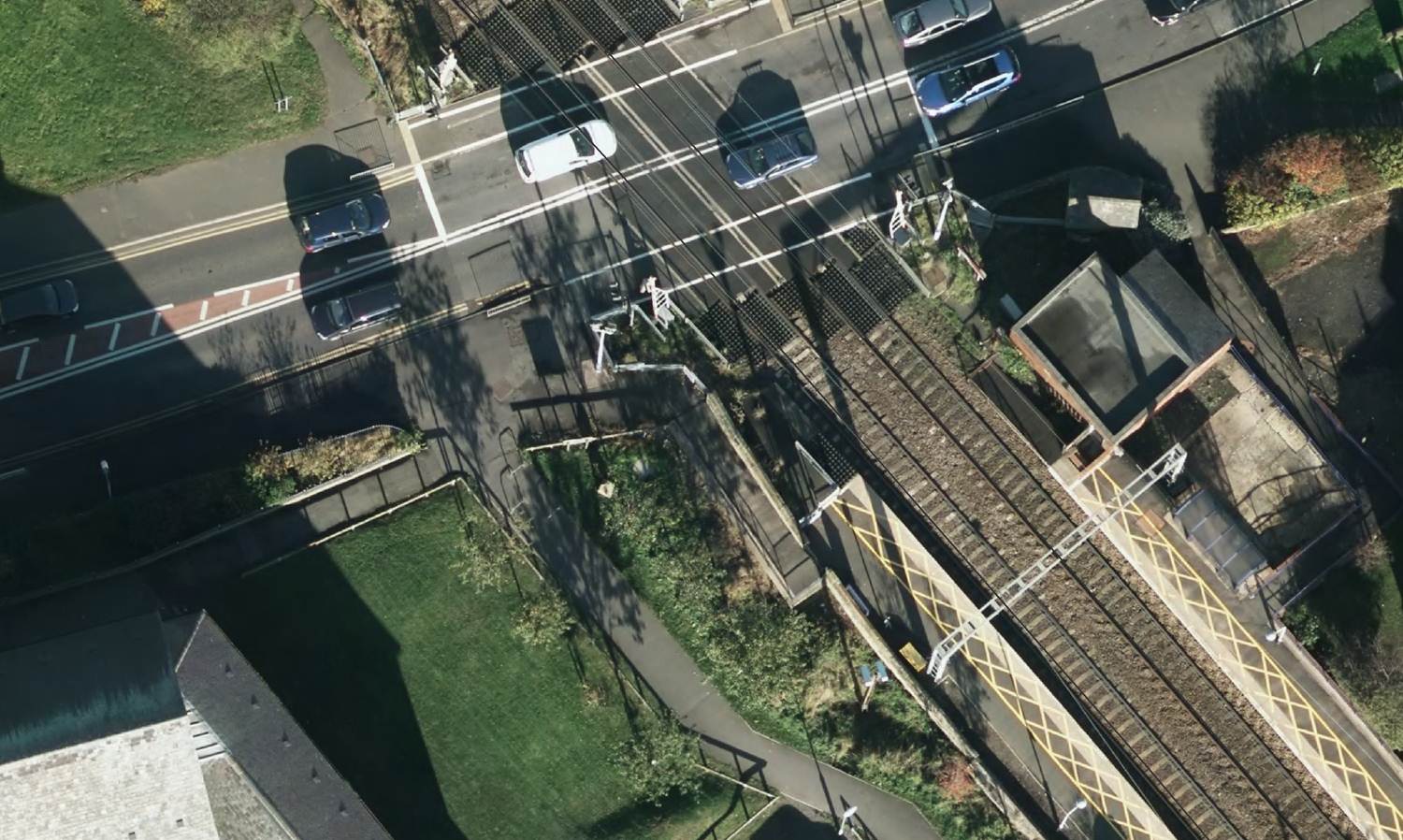
In its current iteration, people can view three types of imagery in the Geo-RINM Viewer: downward-facing imagery; digital surface model and digital terrain model.
“The first data set is the high-resolution imagery, the second two are LIDAR-based imagery,” said Fowler. “Downward-facing imagery provides a high-quality image of the track to help users identify and measure assets, whereas LIDAR imagery shows us both the height of any features and what the ground itself is doing.”

The 3D LIDAR digital surface model includes elevation features, allowing users to understand their worksite, while the digital terrain model allows people to look at cuts and changes in the landscape.
“Both [digital surface and digital terrain models] types of imagery are made up millions of LIDAR points and had to be processed by a team. It is time-consuming to process those LIDAR data points. But we knew what it could bring to the business, and with a high degree of accuracy, how it could be used by our end users. We now have complete aerial survey coverage.”
Through the use of the aerial survey data and the Geo-RINM Viewer, Network Rail maintenance staff can use the tools to help when measuring assets, such as clearances, running line heights and distances between assets. During the planning phase, the Viewer also provides worksite familiarisation, reducing the amount of time spent on track conducting surveys, and in some cases, eliminating the need to visit sites at all.
_edit.jpg)
The data also allows Network Rail to manage its boundaries. “We can now be completely sure what our responsibility is and that of our neighbours,” said Fowler. “We also captured imagery 50m either side of the boundary for community relations or liability negotiations.
“The aerial survey imagery will also allow us to see what we are maintaining. This will allow us to be proactive with protecting signalling and OLE equipment.
“Historically, we’d have had to spend time on track, often in high-risk areas, to plan our works delivery. However, with aerial imagery and 140 data layers accessible in the Viewer, teams can review their proposed worksite before they leave their depot. They can identify the hazards, nearest access point, what materials they need, even before they get to site.”
Data refresh and devolution
This also feeds into Network Rail’s longer term plans to reduce the amount of time staff spend on track. Having recently finished deploying the aerial survey imagery, Fowler told us that attention will turn to keeping the imagery up-to-date as Network Rail builds and renews railway assets such as stations and bridges.
“It’s still early days but we recognise that aerial survey imagery will need refreshing,” he said. “We recognise that IP build new stations or bridges, so the network changes, which is why a refresh rate will need to be identified.”
Asked what further devolution of Network Rail’s routes would mean for the project in the longer term, Fowler said: “Within Network Rail we have our own helicopter and, at the moment, each of the routes can fund imagery for their own route using the helicopter.
“As devolution takes place, it will be up to each route to decide refresh rates. I think it is something that will shape the amount of imagery that is captured in the future but this is still to be decided.”
Phased roll-out and training
During the phased roll-out of the aerial survey imagery, Fowler said the team has delivered a wide range of training. Currently, there are around 6,000 Network Rail users who have access to the Viewer.
“Ultimately, we’ll be giving access to pretty much the entire organisation,” he said. “We haven’t given access to everyone immediately, because we wanted to monitor performance levels.
“We have taken a phased approach of adding on data, and extra capability. We also allocated ‘super users’ who we view as being passionate about having access to the new capability. We then did workshops with them, describing the new capability and giving them a live demo.
“Once the survey data has gone live for a route, we also do a series of road shows engaging with the users and showing them the capability of the tool. On top of that, we have a strong Network Rail intranet presence with demonstration videos on how to use the technology. That is available for all our end users to use.”
There are also training guides and user documents for using the Viewer and the aerial survey data in different ways from vegetation to station management.
“Each role in Network Rail will use the Viewer differently and for different functionality,” said Fowler. “The aerial survey side is used by everyone but when you drill-down further, some teams won’t need some data sets, such as environmental information or work bank data. We’ve drawn up tailored communications around this.”
During the roll-out, the Viewer has not been a static tool with new capabilities added throughout each phase. “Once we get to 10,000 users we will plateau and then add new capabilities to monitor performance,” noted Fowler. “Then we’ll look to increase to around 16,000 and then once the bulk of the capability has been deployed we then increase to 25,000 and, ultimately, beyond 30,000.”
He told us that the current release plan stretches to the end of 2017, with significant new enhancements delivered between now and then.
For example, later this year the team will introduce a tree database in the Viewer. This will colour code trees with regards to their level of risk, allowing users to see “what the likelihood is that the trees could be a risk in bad weather”.
Buried services and mobile RINM
By the end of 2016, the RINM team will support buried services data, which could significantly reduce the amount of time taken in the planning stage.
“Currently, at Network Rail, in order to access buried service data, we have to fill out paperwork that takes around 12 weeks from our underground services office,” said Fowler.
“We are now, however, trying to make that capability available within the Viewer.”
This would mean that users could toggle on the buried services data, highlighting where potential signalling and cable problems could arise, Fowler told us.

“We will also be able to see third-party buried services, such as Scottish Power and National Grid,” he added.
“We’re looking to roll that out by the end of 2016. Again, our users will be able to look at aerial survey imagery – looking at the height of features, and looking at what the ground is doing – but also see what is happening beneath the ground.
“It also means everything is available in one place. So, people don’t have to load up multiple programmes to view potential buried services risks, which can cause project overruns.”
At the moment, RINM is a desktop tool. However, over this summer, the team will be trialling mobile RINM on iDevices.
“As part of the ORBIS programme we gave around 13,000 maintenance people iPhones and iPads,” said Fowler. “And, as part of ORBIS, we’ve been rolling out a suite of apps to allow a lot of our end users to do their work electronically, as opposed to paper based. RINM ties into that.
“Rather than the maintenance guys having to upload a laptop they will be able to view RINM on their iDevice. This will allow them to highlight risks, be briefed before they get to site and view the information out on track.
“They will also be able to temporarily store data on their iPad, in a cache almost, because some 3G signals can be weak and patchy on some parts of the network. So, data sets can be downloaded onto the mobile device.”
This new way of working will go out to the civils and construction community first of all, and once it is embedded with them Network Rail will look to roll out to other communities within the maintenance side. Fowler added that RINM is the cornerstone of ORBIS, but as the model and new ways of working are introduced across Network Rail it will also be one of the “foundation stones” behind Digital Railway.
Tell us what you think – have your say below or email [email protected]