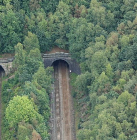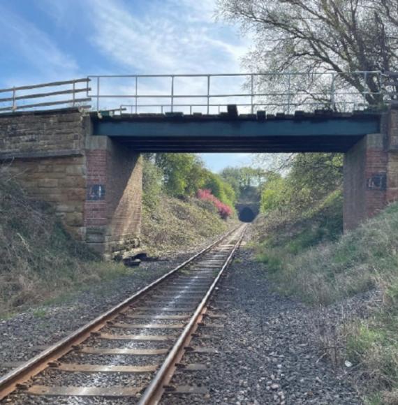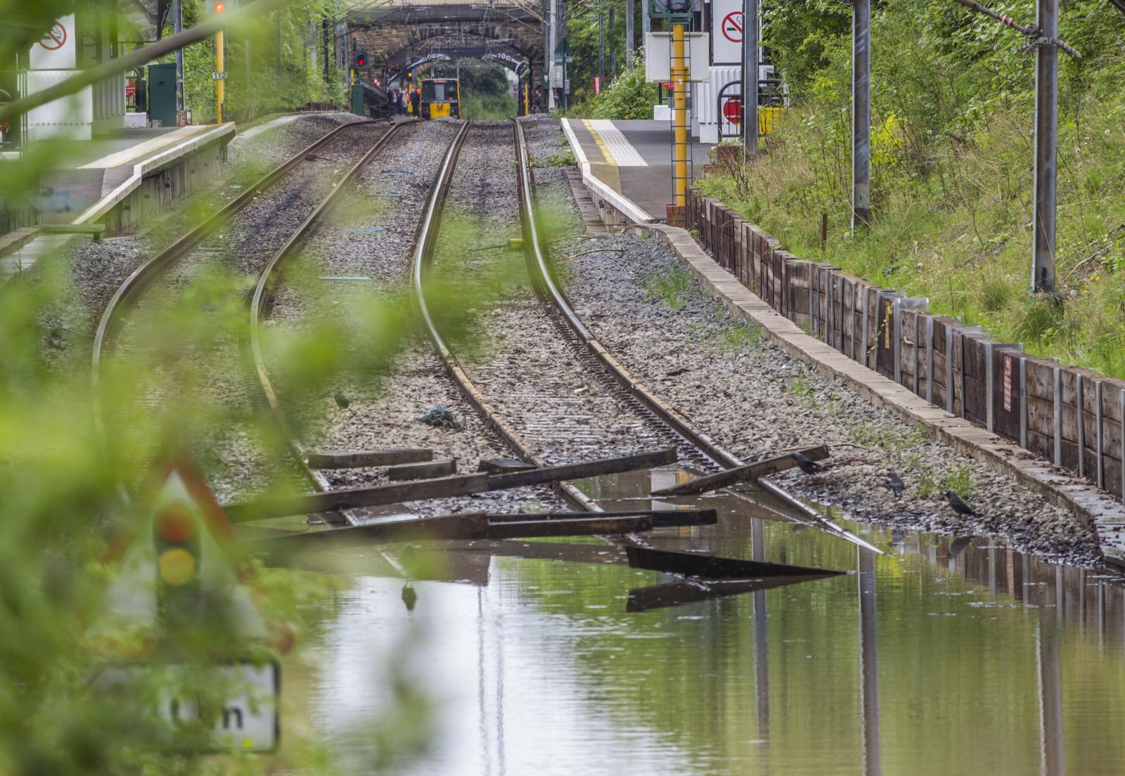

England’s rail network faces escalating disruption risks as climate‑related flooding intensifies, with new analysis from Ordnance Survey (OS) revealing the extent to which key commuter routes, regional lines and coastal connections could be cut off during extreme weather events. The findings highlight a growing vulnerability across both road and rail infrastructure, but the implications for the rail sector in particular suggest significant future challenges for reliability, connectivity and economic resilience.
The analysis combines the Environment Agency’s latest flood data with OS’s National Geographic Database to map where rail lines intersect with river and sea flood zones defined as having a 1‑in‑1,000 annual chance of flooding—modelling that already accounts for existing flood defences. By assessing full sections of rail line between junctions, the study provides a clear national picture of where flooding could sever services entirely.
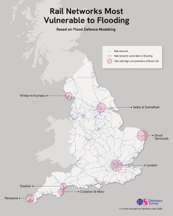
At the national level, OS records 3,003km of rail lines—20% of England’s entire network—within the highest‑risk flood boundary for river and sea flooding. This includes hundreds of kilometres of key commuter, regional and long‑distance services whose function is critical for economic mobility, freight distribution and passenger travel.
Rail Communities at Risk of Complete Isolation
The most attention‑grabbing finding for the rail sector is the number of communities at risk of being entirely cut off. Thirty-six local authorities face the threat of complete rail isolation, where every rail line providing access lies inside the highest‑risk flood zone. These include:
- Kirkby‑in‑Furness (Cumbria)
- Collaton St Mary (Devon)
- Swinefleet and Belton (East Riding of Yorkshire)
- Bradwell and Burgh Castle (Great Yarmouth)
In these areas, OS modelling indicates 100% of rail access routes fall within the most severe flood-risk categories for tidal or river flooding. This represents a profound vulnerability: a single tidal surge or rapid river rise could leave entire communities without any rail service, isolating residents and severing economic links.
Key Commuter Lines Exposed
OS highlights significant exposure across well‑used commuter corridors. Two Thames Valley branch lines into London—the routes to Marlow and Henley‑on‑Thames—are flagged as particularly vulnerable to river flooding. Both lines serve dense commuter populations and provide vital first‑mile/last‑mile connectivity to the capital.
Elsewhere, the scale of exposure is notable at major stations and hubs:
- Penzance: 71% of rail infrastructure vulnerable
- King’s Lynn: 71% vulnerable
- Walsall: 67% vulnerable
- Stamford: 66% vulnerable
- Exeter: 65% vulnerable
- York: 52% vulnerable
These are significant rail centres handling passenger flows, regional connectivity and freight activity. The vulnerability of such high‑profile railway towns underscores the breadth of the challenge for national rail resilience planning.
Freight and Strategic Economic Links at Threat
Rail freight corridors, essential for logistics chains serving ports, distribution centres and manufacturers, are also swept into the highest‑risk zones. Coastal and estuary‑side infrastructure—where freight routes commonly run parallel to rivers or shoreline—is disproportionately exposed. Disruption at these pinch points could delay goods, disrupt supply chains and weaken overall productivity.
The exposure of routes in the South West, Yorkshire and the East of England raises particular concerns for lines supporting:
- Intermodal freight
- Aggregates transport
- Manufacturing supply chains
- Port‑to‑inland distribution movements
Any prolonged outage would have knock‑on effects across the national freight timetable.
Urban Rail Vulnerability Mirrors Road Exposure
The OS analysis reports widespread vulnerability in major urban centres. While road isolation dominates much of the headline risk—London boroughs such as Kingston upon Thames, Sutton, Waltham Forest and Hounslow all show more than 38% of their access roads at risk—there is a rail parallel.
In Greater Manchester, which faces considerable road exposure, rail vulnerability deepens the threat of multi‑modal shutdowns during severe flooding. Central Manchester, Old Trafford and Salford all face significant risk to their access infrastructure, creating scenarios where both rail and road could be compromised simultaneously.
Tidal Flooding Poses a Growing Rail Threat
Coastal rail infrastructure is particularly exposed. Tidal flooding risk is highest in locations such as:
- Great Yarmouth – commuter lines to Exmouth and regional connections
- Penzance – 92% of rail infrastructure at risk
- Selby – 65%
- Dawlish – 53%
Dawlish, long known for storm‑related disruption and famously repaired following the 2014 sea wall collapse, remains vulnerable according to the OS modelling. With climate change increasing storm intensity, the risk to coastal railways remains pronounced.
Industry Implications: Planning, Investment and Data
Ordnance Survey positions the findings as evidence of the critical role geospatial data must play in shaping long‑term transport resilience. Tom Gray, Transport Market Development Lead at OS, said:
“Disruption from flooding on rail and road networks is increasing as climate change continues, turning what was once an occasional challenge into a persistent planning reality.”
He adds that infrastructure and housing investment increasingly demands resilience as a core requirement:
“These projects depend on secure funding, compliance with climate resilience regulations, ESG reporting metrics, appropriate insurance and effective mitigation measures—all of which require a clear, forward‑looking understanding of environmental risk.”
The analysis reinforces a message repeatedly raised across the UK rail industry: climate resilience planning is no longer optional. Strategic use of geospatial intelligence, climate modelling and integrated infrastructure planning will be fundamental to ensuring England’s rail network remains reliable, connected and economically viable as weather volatility increases year‑on‑year.
Image credits: iStock & Ordnance Survey