30.10.18
Taking to the skies
Source: RTM Oct/Nov 2018
Network Rail’s commitment to driving innovation is best encapsulated by its latest scheme involving high-definition imagery drones, or UAVs. RTM’s Jack Donnelly sat down with the Thameslink Programme Network Rail project sponsor, Paul Ashman, to find out more.
When a piece of Thameslink track requires surveying, conducting the process from start to finish can be quite a laborious task. A crew is normally required to physically survey the line, including some staff ‘lookouts’ who are needed whilst they conduct the survey on the track to protect their safety. In some instances, a whole section of the line needs to be closed – leading to negative impacts on the rail network far beyond just that one section of track.
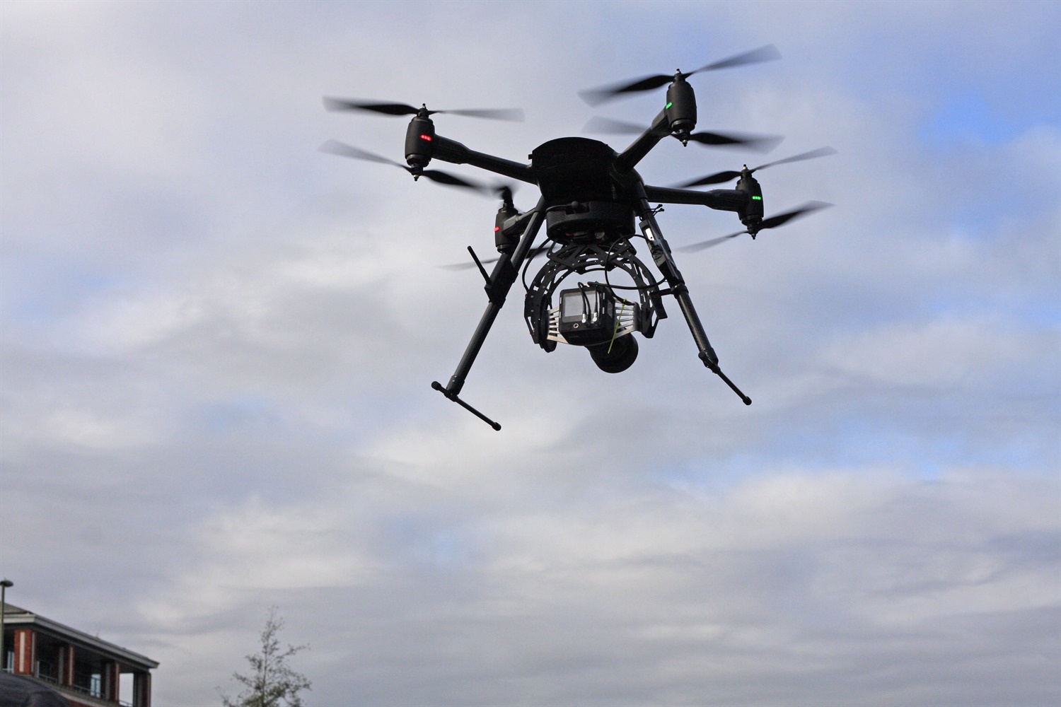
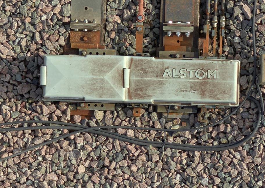
But what if technology could be introduced which could drastically reduce the disruptive knock-on effects that closing sections of track inevitably lead to? Enter the Vogel R3D Advanced UAV. Released last year with programming built in by surveying company Plowman Craven, the advanced ‘high-definition imagery drone’ does more than simply film the horizon. With a 100-megapixel medium format camera, capable of surveying faults on the line with a sub-5mm accuracy from a 25m working height, the UAV drone reduces risk, cost and time, whilst providing the exact same service that using manned crews would deliver.
Paul Ashman, Network Rail’s sponsor team representative on the Thameslink Programme, said that with more and more different types and capacities of rolling stock running through across the Thameslink network, challenges arise that may sometimes require a closure of the track for infrastructure changes to be made.
“On the Thameslink Programme we wanted to find a way to absolutely minimise disruption to passengers. The project team was keen to find a solution that would allow us to keep the line open while surveying for turn-back locations that don’t currently exist, such as at Redhill and Three Bridges stations, for the new longer Thameslink Class 700 trains, which the new type of drone gave us,” Ashman told me.
“One of the areas where there’s always a challenge on the railway is on the possession planning side of things. You have a lot of different stakeholders with different operational interests, so generally gaining access in the first place to an operating railway can be quite challenging. It’s very difficult to get on site in a short space of time, so you end up having to talk about long-term planning. The beauty of utlising drone technology is that the challenge of having to access track is removed. With nobody on the track, there are obvious safety benefits too.”
Boots off ballast

Previously, fledgling drone technology would not have been able to accurately and definitively map the line as well as the Vogel R3D UAV can. When carrying out the aerial survey, operators conduct two “passes” of the surveyed land: the first pass includes the drone’s camera pointing directly downward, whilst the second angles the camera at a tilt, allowing a 3D geometric picture to be captured.
The new technology pioneered by Plowman Craven allows staff to send the drone up into the air to conduct a topographical survey using 3D Cloud Point technology, returning high-resolution imagery in real time and allowing Network Rail to make snap-decisions on the best course of action using Building Information Modelling (BIM). One of the best outcomes of this advancement, according to Paul, is that fewer personnel are required.
“What is particularly innovative about the new UAV is that the survey data is very detailed, so you’re talking about very high levels of accuracy,” he explained. “Where drones could be used elsewhere to capture video footage of any structural problems in inaccessible areas, the key here is about the ability to capture very accurate data – and that in itself would negate the requirement for access to the operational rail network and not expose our people to unnecessary risk.
“If you look at overall surveying efficiency, cost is a big factor too, as is the level and quality of data produced. So the quality of the information would remove the need for repeated site visits, and you have very accurate information that’s scanned in a very short period of time.”
Total control
The use of commercial drones has garnered some negative attention in national press recently: several cases of ‘near-miss’ instances with the remote-controlled flying robots and major aviation transporters – including jumbo jets and helicopters – means Network Rail’s attention to detail must be stringent.
Ashman noted, however, that enhanced driverless technology on the Vogel R3D allows the drone to remain under control at all times. He explained: “The drone has a predetermined flight path. There’s a grid applied across the route that is being surveyed – so the drone would go up, follow this flight path, and the operator would be on hand to make sure things are going to plan. It’s almost like a driverless technology that is simply sped up and slowed down accordingly along the flight path.”
This effortless control allows Network Rail to make note and plan for areas which may need rectification or marking for other improvement, and the high-definition imagery returned swiftly to the user allows for any maintenance or enhancement to be implemented quickly and efficiently.
What the future holds

Given the evident tangible benefits, Network Rail is starting to use drone technology more frequently across the network – but how much scope does a service like this have compared to traditional methods?
Paul stated that there is “fantastic potential” in the scheme. “If you look at some of the large infrastructure schemes that there are around at the moment, some of them are significant remodelling exercises – for example at East Croydon.
“If drone technology is applied, all of this information just becomes available so easily compared with shutting down the whole line and doing the additional surveys.”
In fact, Paul argued it could be only a matter of time before aerial surveying technology changes the landscape of the UK rail industry. “If you look at the traditional surveying methods Network Rail commonly uses, it’s known technology,” he continued.
“Through this project and others, we are gaining an understanding of what technology can really do, and that understanding is helping us to make cost savings while improving safety at the same time.
“I think the fact is that once it becomes more commonly accepted, if you look at it from our side of things, our IP signalling colleagues say it was a moment of inspiration of how we can tackle schemes in the future.
We asked: ‘Has anyone thought of drone surveys? Is there the capability?’ When we explored it further, we thought ʻyes, there’s a terrific opportunity here.ʼ”
With criticism from the ORR-led rail review into the summer timetable chaos, it is all the more important that infrastructure enhancements do not have a knock-on effect on passenger services. The Network Rail Thameslink Programme team’s harnessing of innovation and technology may just be the answer to these dilemmas.
As Network Rail drives technological innovation through Thameslink, the rest of the industry should look to follow suit. In fact, if the rail sector is serious about the high-quality delivery of services through technology, then it may just depend on it.
Enjoying RTM? Subscribe here to receive our weekly news updates or click here to receive a copy of the magazine!